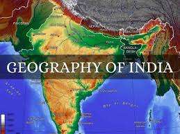
The article shows the detail understanding of 3 Major Distribution of Physical Geography of India.
With a total land area of more than 1.2 million square miles, India is the second biggest nation in Asia, after China, and the seventh largest in the globe. It is located in South Asia. Given that three of its sides are covered in water, India is regarded as a peninsula. India shares borders with seven nations to the north: Bangladesh, China, Pakistan, Bhutan, Myanmar, Afghanistan, and Nepal.
India is home to several stunning terrain. The Himalayas, Mount Everest, the Eastern and Western Ghats, and the Western Ghats are a few of these landforms. India has a wide variety of geographical characteristics. Mountain ranges, plains, plateaus, deserts, wetlands, and archipelagos are six of these geographical characteristics.
The major characteristic of the geography of India are:
1. Great Northern Mountains of India- Physical Geography of India
The northern frontiers of India are defined largely by the Himalayan mountain range, where the country borders China, Bhutan, and Nepal. Its western border with Pakistan lies in the Karakoram and Western Himalayan ranges, Punjab Plains, the Thar Desert and the Rann of Kutch salt marshes. In the far northeast, the Chin Hills and Kachin Hills, deeply forested mountainous regions, separate India from Burma. On the east, its border with Bangladesh is largely defined by the Khasi Hills and Mizo Hills, and the watershed region of the Indo-Gangetic Plain. These are spread over 2400 km with three parallel ranges:
- Himadri: It is the northern most range of 6000 meters and consist of Mount Everest, Nanga Parbat, K2.
- Himachal: It is of lesser Himalaya (4000 meter) and consist of Dhauladhar, Pir Panjal and Purvanchal ranges.
- Shivalik: It is the outermost range (approx. 1000 meter) consist of valleys which lies between Himachal and Shivalik known as Duns.
2. Northern Plains- Physical Geography of India
The Indus, Ganges, and Brahmaputra are the three principal rivers that dominate the vast alluvial plains that make up the Indo-Gangetic lowlands, sometimes referred to as the Great Plains. They drain the majority of northern and eastern India and run parallel to the Himalayas from Jammu and Kashmir in the west to Assam in the east. The plains cover an area of 270,000 square miles, or 700,000 km^. The Ganges, Indus, and Brahmaputra, as well as its principal tributaries, the Yamana, Chambal, Gomti, Ghaghara, Kosi, Sutlej, Ravi, Beas, Chenab, and Tista, are the principal rivers in this region. The Ganges Delta also includes rivers like the Meghna.
It lies between mountain and peninsular plateau. The Ganges, Indus, Brahmaputra and their tributary rivers flows in the plain. The land is very fertile and good for agriculture. It is divided into four regions:
- Bhabar region: It starts from foothills of Himalayas and is almost 8-16 km spread containing stones and pebbles.
- Terai region: It lies south of Bhabar consisting forest.
- Bangar region: It lies south of Terai and is less fertile.
- Kadar region: It lies south of Bangar and is fertile land and much prone to flood.
3. Peninsular Region- Physical Geography of India
The Aravali Range, which spans Rajasthan from northeast to southwest and is the oldest mountain range in India, is around 800 km (500 km) long. The range’s northernmost point, which ends close to Delhi, is comprised of solitary hills and rocky ridges that extend into Haryana. At 1,722 m (5,650 ft), Guru Shikhar at Mount Abu, which is located close to the Gujarati border, is the highest peak in this range. The eroded remnant of a historic fold mountain system is the Aravali Range. The Aravali–Delhi orogen, a Precambrian occurrence, caused the range to rise. The Marwar segment to the northwest of the range and the Bundelkhand segment to the southeast are two of the ancient segments that make up the Indian craton that are joined by the range.
Also Read:
- 5 Best Travel Destinations for Bachelors in India
- Top 5 New Year 2025 Party Destinations for Epic Celebration
- Medical Tourism Scenario in India in 2025
- Indian Festivals in 2025 Celebrating Colorful Traditions
- Finding New Opportunities through Case Study of a Indian Startup- Chumbak
It lies south of Northern plain. The Anamudi (2695 mtr) of Kerala is the highest peak. The central highland is in south of Narmada river includes Mahua Plateau, Chotanagpur, Meghalaya, Vidhya, Satpura, Aravalli. The highest peak is Guru Shikhar (1722 mtr). The Deccan plateau lies in Satpura range in north, Eastern Ghat in east and western Ghat in west. Rivers flow from west to east.
- Thar Desert: It lies in Rajasthan, Gujarat, Haryana, Punjab and Pakistan. The river Luni flow from this land.
- Coastal Plains: Andaman & Nicobar Islands in Bay of Bengal, Lakshadweep in Arabian Sea are famous coastal region of India.


Comments are closed.